

Defence Networks
Defence network equipment - reliable solutions for your project.
FTI designs and manufactures a range of Fibre Optic Communication Network Equipment for UK & Worldwide Defence Markets
The Network Equipment provides high system-availability, resilient
communications including self-healing networks, path protection with
auto changeover. FTI's Fibre Optic Communication Equipment interconnects
various Manufacturers of Military Radars.
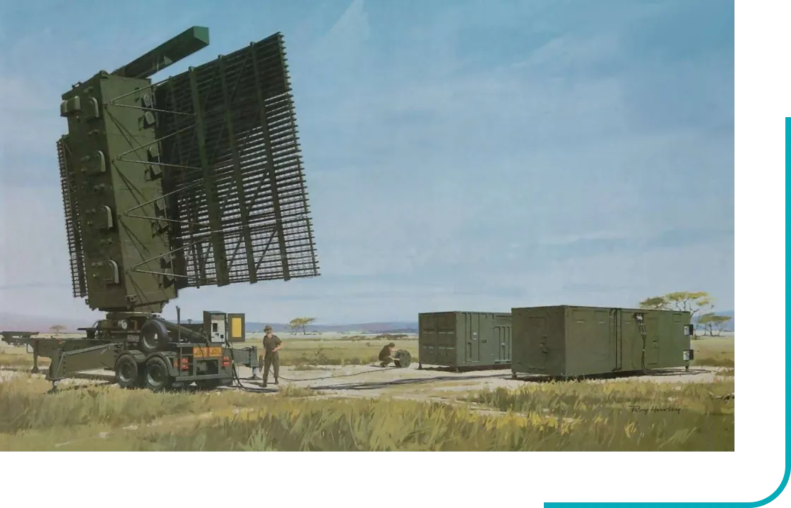
A notable example is Alenia-Marconi's Martello S – 743D supplied to the Royal
Malasian Air Force. The Primary Radar Trace produced to the World’s Media
a few days after the disappearance of Flight MH370 came from Bukit Puteri
Radar, reportedly a Martello S – 743D, with a listed range of 270NM. The
Alenia-Marconi S - 743D Radars in Malaysia are networked over field deployable
Fibre Optic Cable via FTI's equipment.
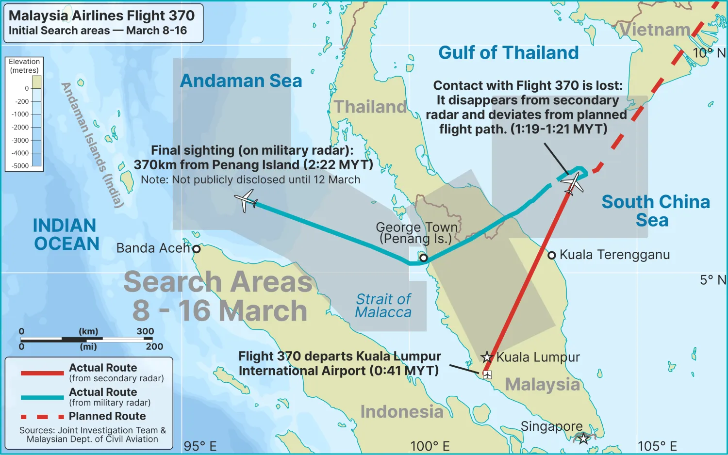
Let us go back to that wee hours on Saturday, 8th March 2014. MH370 took
off from Kuala Lumpur International Airport at 0041 hours (Local Time). At
0107 hours, the Aircraft Communications Addressing and Reporting System (ACARS)
transmitted that all was well with the aircraft. The aircraft soon after
arrived at waypoint IGARI, about 78 nautical miles from Redang island, bearing
056 degrees) which is a point in the South China Sea between the Malaysian
border with Vietnam.
At this point, Lumpur Flight Information Region (FIR) would hand over
the control aircraft to Vietnam. At 0119 hours, a person believed to be
the co-pilot transmitted the final vox transmission, “Alright, good
night.” At 0122 hours, the aircraft disappeared from secondary radar
coverage without any distress call suggesting its transponder had been
switched off by someone on the flight deck. However, it was only at 0240
hours that Malaysia Airlines was notified.
The RMAF Air Defence radars saw the MH370 tracked West Southwest to waypoint
VAMPI (68 nautical miles East Northeast of Lhokseumawe, Indonesia), then
Northeast to waypoint GIVAL (69 nautical miles South Southwest of Phuket
International Airport) before tracking Northwest towards waypoint IGREX (100
nautical miles East Southeast of Car Nicobar airport on India’s Nicobar Islands),
the last known position according to the primary radar. Where MH370 went
to after this point is unknown at this point, but I believe the Indian Air
Force’s Andaman and Nicobar Command’s primary radar there would have caught
the MH370 in its scope.
Do you have any questions?
For further information please contact FTI.
You can ask us a question
using the form or please call us on
+44 (0) 24 7641 7070.